
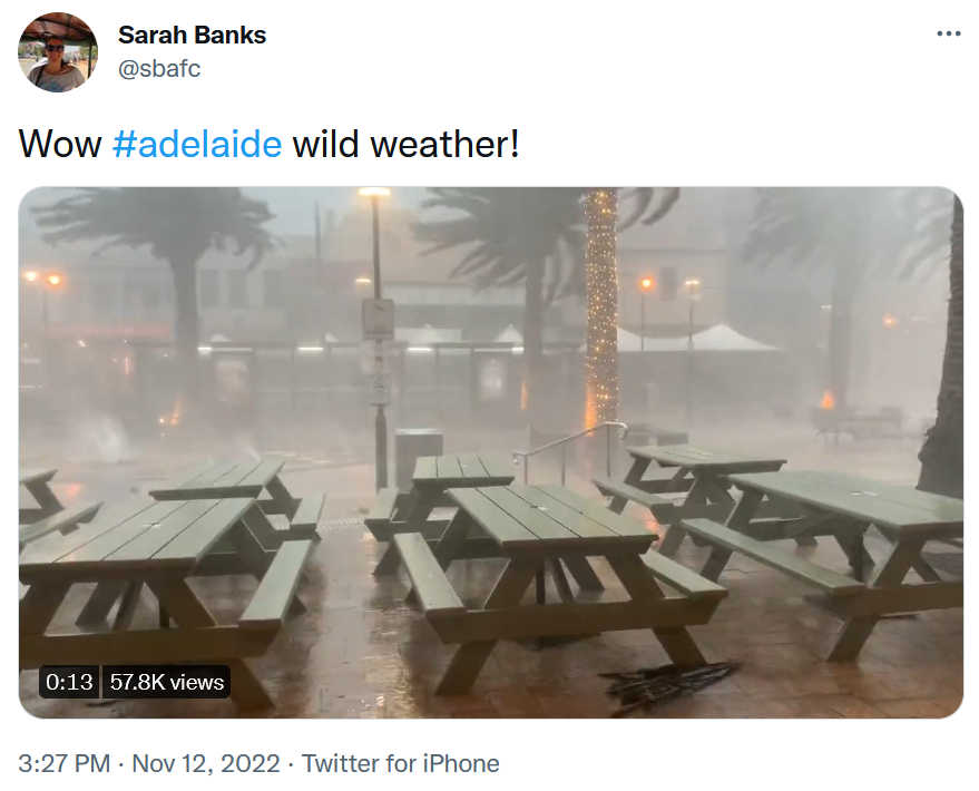
On Saturday afternoon, Adelaide and much of southern South Australia endured one of the strongest thunderstorms in recent memory. The storm caused:
- Flash-flooding, with rain totals of 25-50 mm in a very short period around Adelaide, and totals in excess of 50mm on the Fleurieu Peninsula, just south of Adelaide.
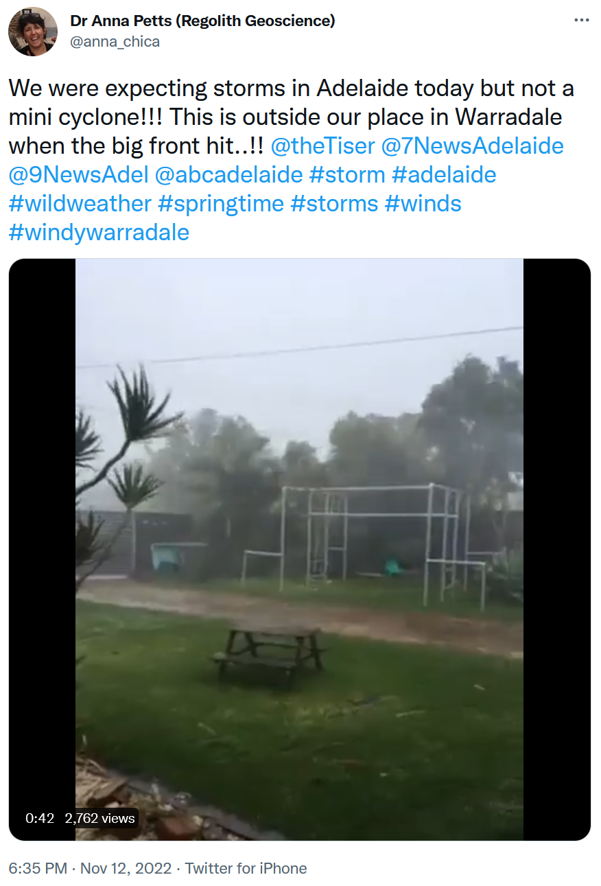
- Wind gusts in excess of 100 km/h that brought down huge trees.
- Blackouts that left hundreds of thousands of people without power.
Fortunately, there have been no reports of deaths or serious injury, however thousands of homes remain without power and numerous schools and businesses are closed this Monday.
But what made this storm so strong?
On Saturday morning, Weatherzone meteorologist Tom Hough gave a detailed account of the factors that were combining to make the atmosphere ripe for explosive storms of the sort we saw.
In the afternoon, Weatherzone meteorologist James Rout covered the storms as they developed, noting that there had been over 125,000 lightning strikes within 300km of Adelaide at the time he was writing his story. That figure would end up being close to half a million, and as WZ meteorologist Ben Domensino noted on Monday, 4.2 million ligthning strikes in all were detected across the country over the weekend.
In simple terms, what made the conditions so explosive (as you can see in the video above) was the combination of an unstable atmosphere and a surface trough (low pressure) which enabled the formation of a squall line.
A squall line is essentially a long, well “organised” line of thunderstorms in a narrow, slightly curved band. Saturday’s squall line stretched from SA’s North West Pastoral forecast district all the way down to the Lower South East forecast district, before it swept onwards to the Victorian border.
The squall line formed in such a way that the updrafts ahead of it sucked up air, then the downdraft hit the ground and helped to propel the storm forward. This eventually caused the squall line to outrun the surface trough that created it.
All that air rapidly rising and falling explains the wind and rain rates similar to those in a low grade tropical cyclone, which were briefly experienced in most areas as the storm passed over.
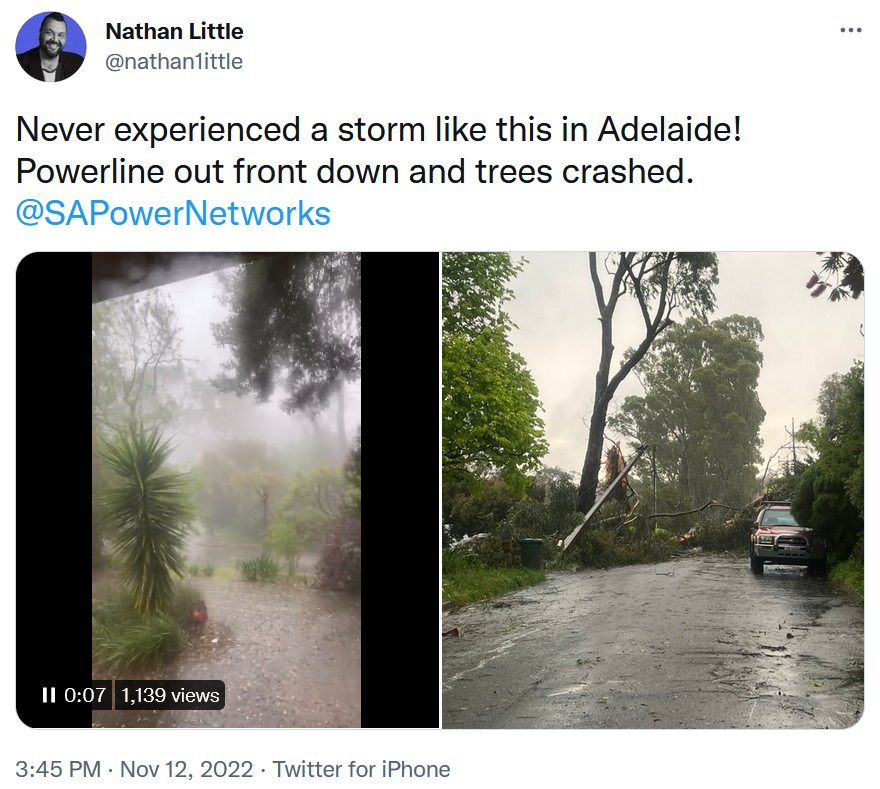
Meanwhile, South Australians are still mopping up today. The state doesn’t often receive weather of this intensity, so numerous large trees are still being cleared from homes and streets. The electricity grid was disconnected from the National Electricity Market after a major tower came down at Tailem Bend, southeast of Adelaide, although the grid remains in a secure operating state, according to AEMO.
As for the weather in Adelaide and the state’s southeast for the coming week, an unseasonably cool few days are on the cards under the influence of southerly winds, and while another system with showers and storms looms for next weekend as the weather warms up, there is far less potential for destructive weather.
This article was originally posted on Weatherzone and has been republished here with permission.
About our Guest Author
 |
Ant Sharwood is a Journalist at Weatherzone.
Weatherzone, a DTN company, is Australia’s largest private weather service and was established in 1998. Their team of highly qualified meteorologists understands the effect the weather has on the day to day operations of businesses of all kinds. They also run Australia’s most popular consumer weather website and mobile app. Weatherzone provides market-leading weather insights to more than five million Australians and over 15 industries, including energy, mining, agriculture, ports, aviation, retail, insurance, broadcast media and digital media. You can find Weatherzone and Ant Sharwood on LinkedIn. |
Leave a comment