
Tuesday was a dangerous and damaging day of weather in Victoria as powerful winds, severe thunderstorms, catastrophic fire danger and mass power outages impacted the state.
The burst of ferocious summer weather was caused by a strong cold front and pre-frontal trough passing over the state, which caused a cold air mass from the Southern Ocean to clash with a much warmer air mass sitting over Australia’s southeast.
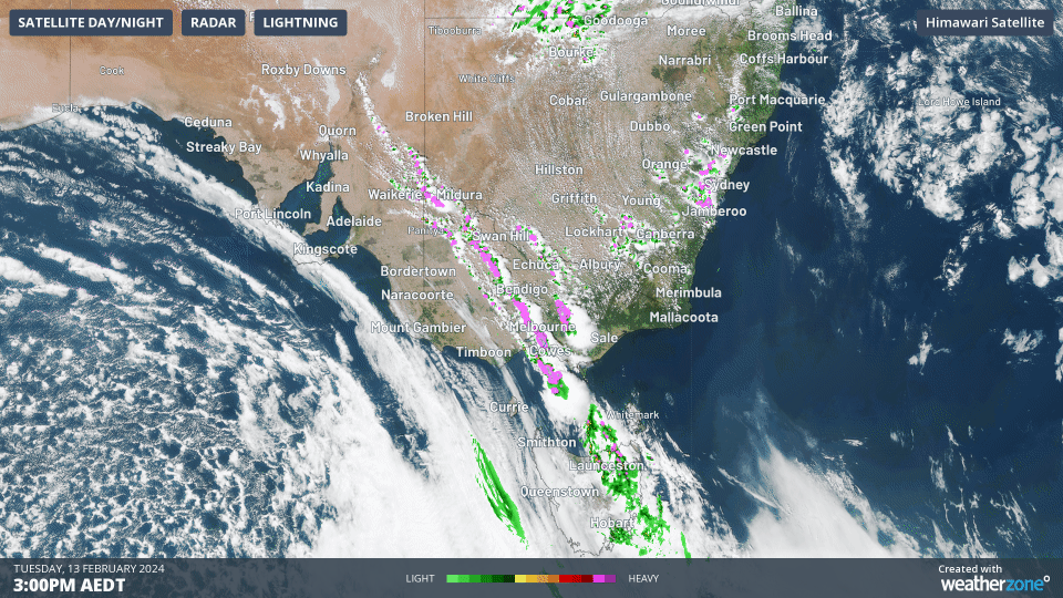
Image: A squall line around 1,500 km in length causes lightning across parts of four states on Tuesday afternoon.
This volatile weather pattern caused powerful winds and severe thunderstorms, which produced:
- A wind gust of 130 km/h at Mount Gellibrand shortly before midday, which is equivalent to a category two tropical cyclone
- Wind gusts of 126 km/h at Yarram Airport, 122 km/h at Avalon Airport, 119 km/h at Eildon Fire Tower, 117 km/h at Swan Hill, 115 km/h at Fawkner Beacon and102 km/h at Melbourne Airport
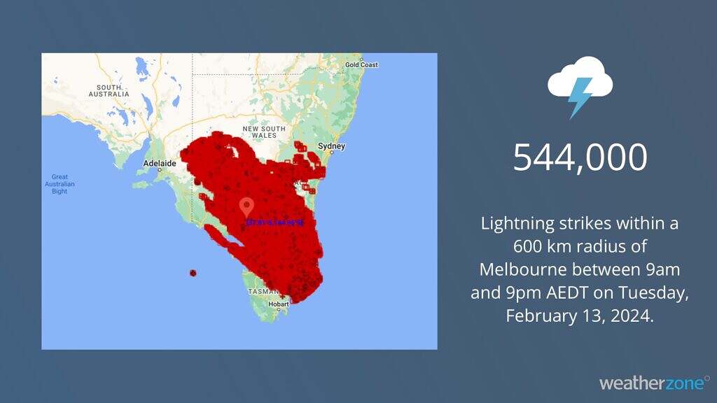
- 543,762 lightning strikes within a 600 km radius of Melbourne between 9am and 9pm AEDT on Tuesday
- Dry lightning that ignited new fires amid Extreme to Catastrophic fire danger ratings
- A massive squall line, which resulted in thunderstorms stretching roughly 1,500 km across parts of Vic, NSW, SA and Tas
- Large hailstones falling from fast-moving severe storms
Tuesday’s powerful winds caused six transmission towers to collapse near Anakie, to the north of Geelong, resulting in power outages to more than 500,000 customers. According to Victorian Energy Minister Lily D’Ambrosio, this has been one of the largest outage events in the state’s history.
Some of the lightning caused by Tuesday’s thunderstorms occurred with little to no rainfall, allowing these cloud-to-ground lightning strikes to ignite new fires. This was likely to be the ignition source for some of the fires that started and got out of control in the state’s west on Tuesday.
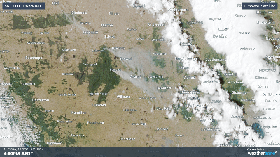
Image: Images captured by the Himawari-9 satellite showing smoke from two large fires in western Victoria on Tuesday afternoon.
As of 10pm AEDT on Tuesday, emergency warnings were still in place for several bushfires in western Vic, while a severe storm warning was also in place for the squall line passing over southern NSW and the ACT.
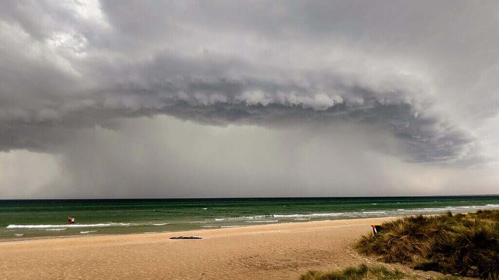
Image: Chelsea Beach, Vic on Tuesday afternoon. Source: Jennifer Erlandsen / Facebook
This article was originally posted on Weatherzone and has been republished here with permission.
About our Guest Author
 |
Ben Domensino is a Communications Meteorologist at Weatherzone.
Weatherzone, a DTN company, is Australia’s largest private weather service and was established in 1998. Their team of highly qualified meteorologists understands the effect the weather has on the day to day operations of businesses of all kinds. They also run Australia’s most popular consumer weather website and mobile app. Weatherzone provides market-leading weather insights to more than five million Australians and over 15 industries, including energy, mining, agriculture, ports, aviation, retail, insurance, broadcast media and digital media. You can find Weatherzone and Ben Domensino on LinkedIn. |
Be the first to comment on "High impact weather lashes Victoria, igniting fires and leaving 500,000 without power"