
The weather forecasts are alerting to the formation of an East Coast Low this week. The low is expected to sit just off the eastern cost of Australia, adjacent New South Wales.
Today on Monday the 30th of June Weatherzone posts how the low is to bring flooding rain, gales, huge waves to eastern NSW.
The low was in the forecast quite clearly last week. DTN noted East Coast Low brewing for coastal NSW next week on Friday the 27th of June.
The low is easy to spot in the Bureau of Meteorology forecast map for the next 4 days:
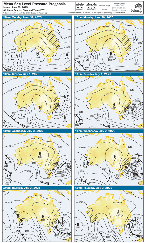
In this forecast the Bureau of Meteorology (as at Monday morning) indicates the low will be well formed by Tuesday and will deepen over Wednesday. It is still there, off the coast of NSW on Thursday, but weaker, looking like it will gradually start moving eastwards.
There is potential for this to drive added uncertainty in electricity generation and demand. Some readers of WattClarity have already noted this in various comments.
Outlook for NSW
In the next snapshot from ez2view we note the 3rd of July (highlighted) as being a potentially tricky day.
There is a proportionally large amount of uncertainty in the total (market) demand forecasts to-date (top).
There is also considerable variability evident in the availability of semi-scheduled solar generators in NSW. For context the installed capacity of large-scale solar is 5,000 MW.
We observe declining availability of wind generators during the 3rd. Currently wind capacity is sitting at 2,600MW.
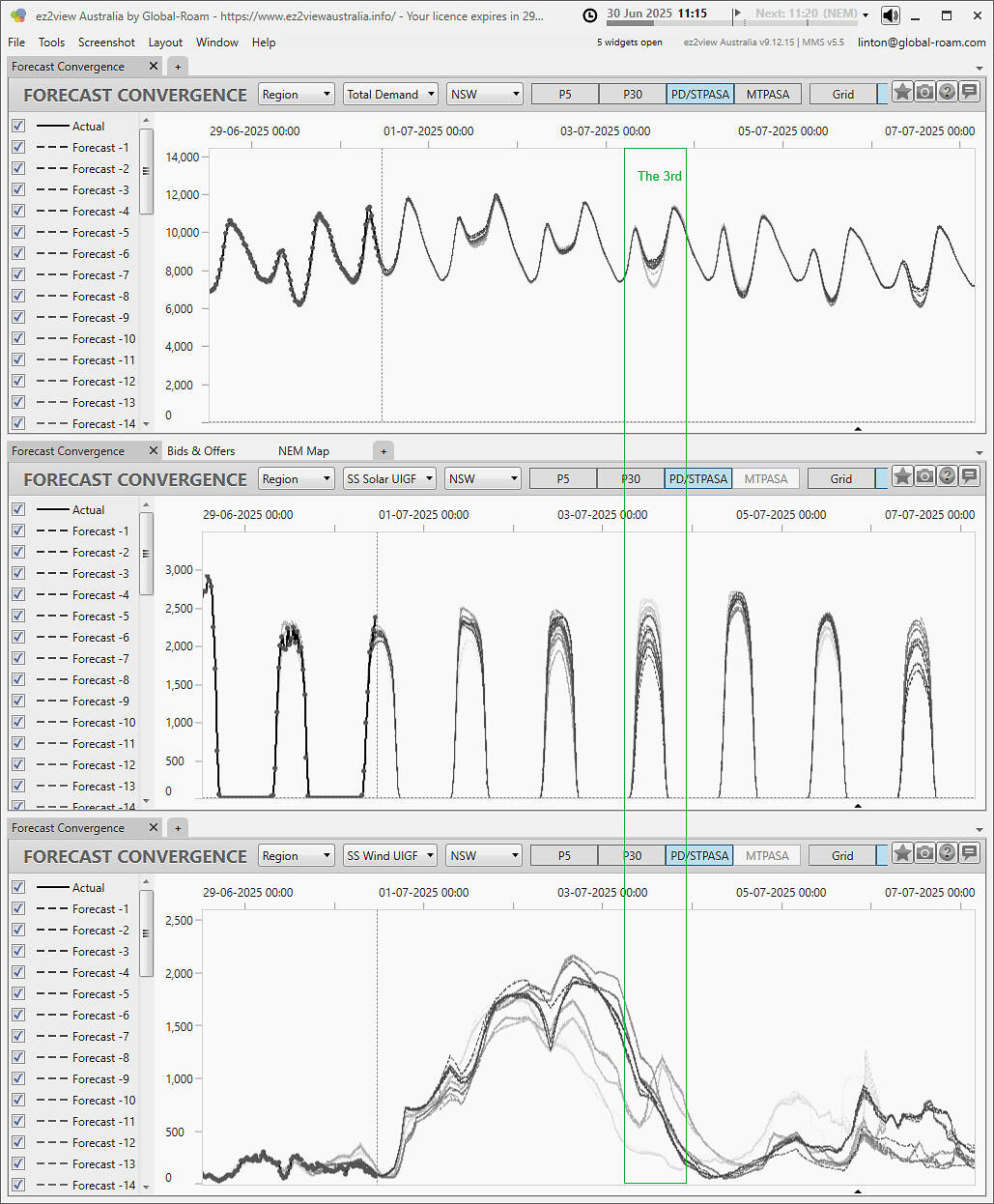
One period to watch. But definitely not the only one as light wind availability appears to be coming on the 4th and 5th, as that high pressure system moves across from SA.
Light winds for SA forecast
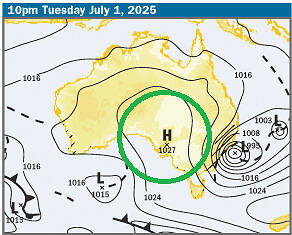
The position of the low appears to help set up a stable high pressure system over South Australia.
We can see that in the Bureau’s outlook charts above. A subset is extracted below. We highlight the high pressure zone projected for 10pm on Monday. Note, the ridge remains in that general position into Thursday.
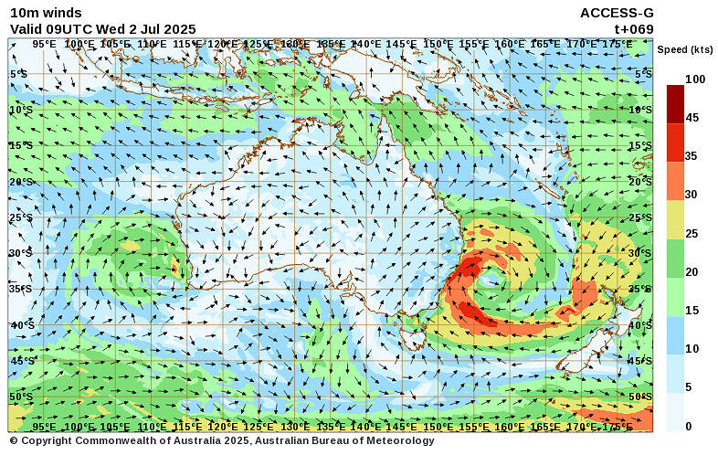
This system will create light winds in SA.
Here is a look (albeit of surface winds) valid for 19:00 (NEM time) on Tuesday 2nd July 2025. We are looking at the 0-5 knot range for much of SA on this chart.
We see the projected impact of the high pressure system on wind generation availability in the Forecast Convergence chart below (bottom). The 2nd of July is higlighted.
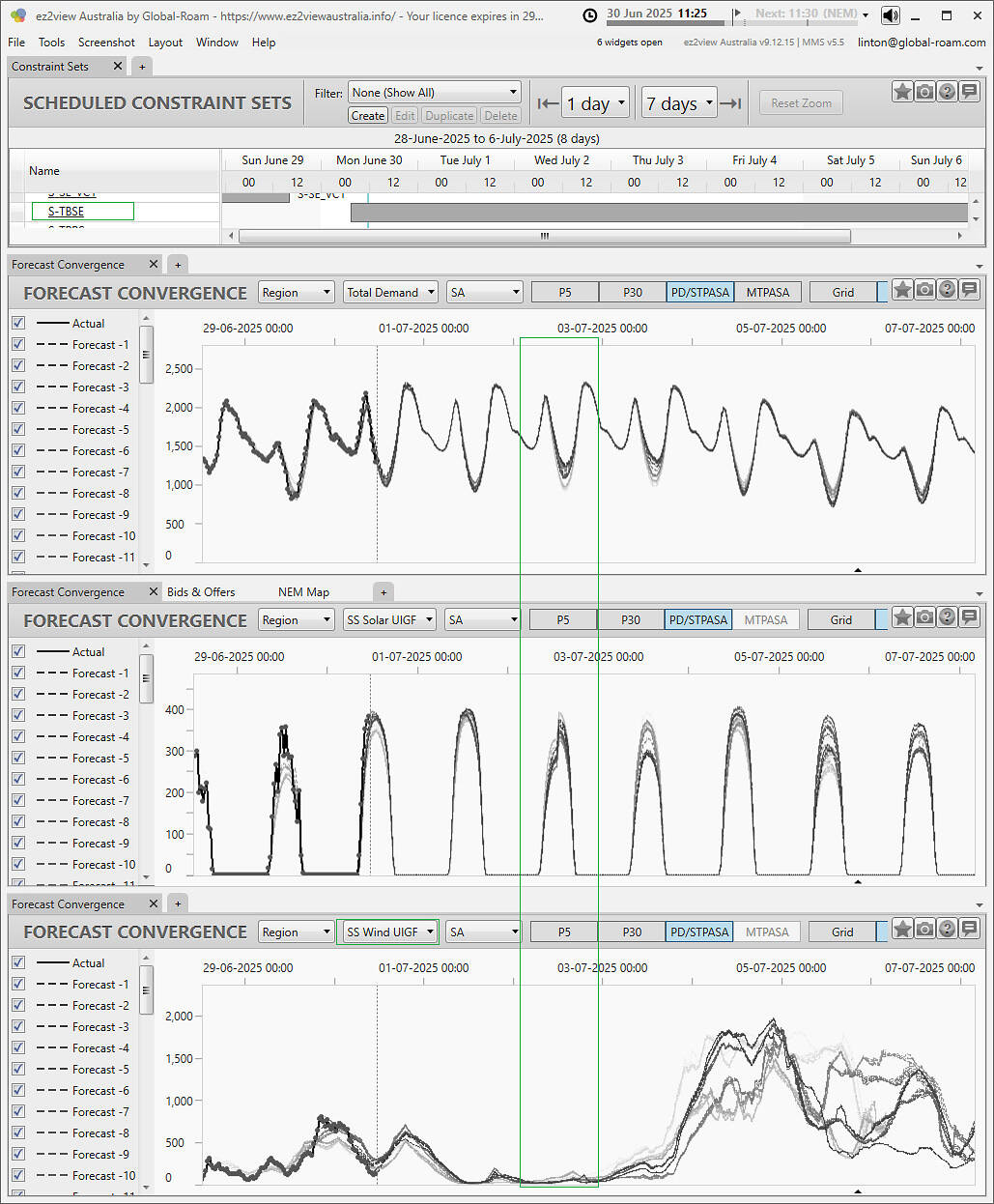
We’ve also highlighted the S-TBSE constraint set which is now invoked. It is expected to run throughout this week. This set appeared to be contributing to earlier LOR conditions in projections made last week.
The reserve situation appears to be somewhat ameliorated in the outlooks available now, but that might be a topic of further investigation and subject to update.
PS1
Fuji-what-the?
No no, Fujiwhara.
Weatherwatch advise the NSW ‘East Coast Low’ may undergo a Fujiwhara Effect, damaging winds & heavy rainfall expected. Read more via Linked In here.
Be the first to comment on "East coast low brings challenging conditions for start of July in 2025"