
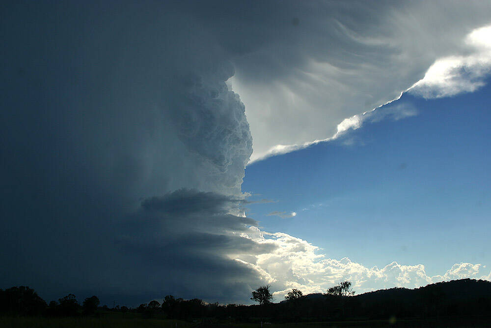
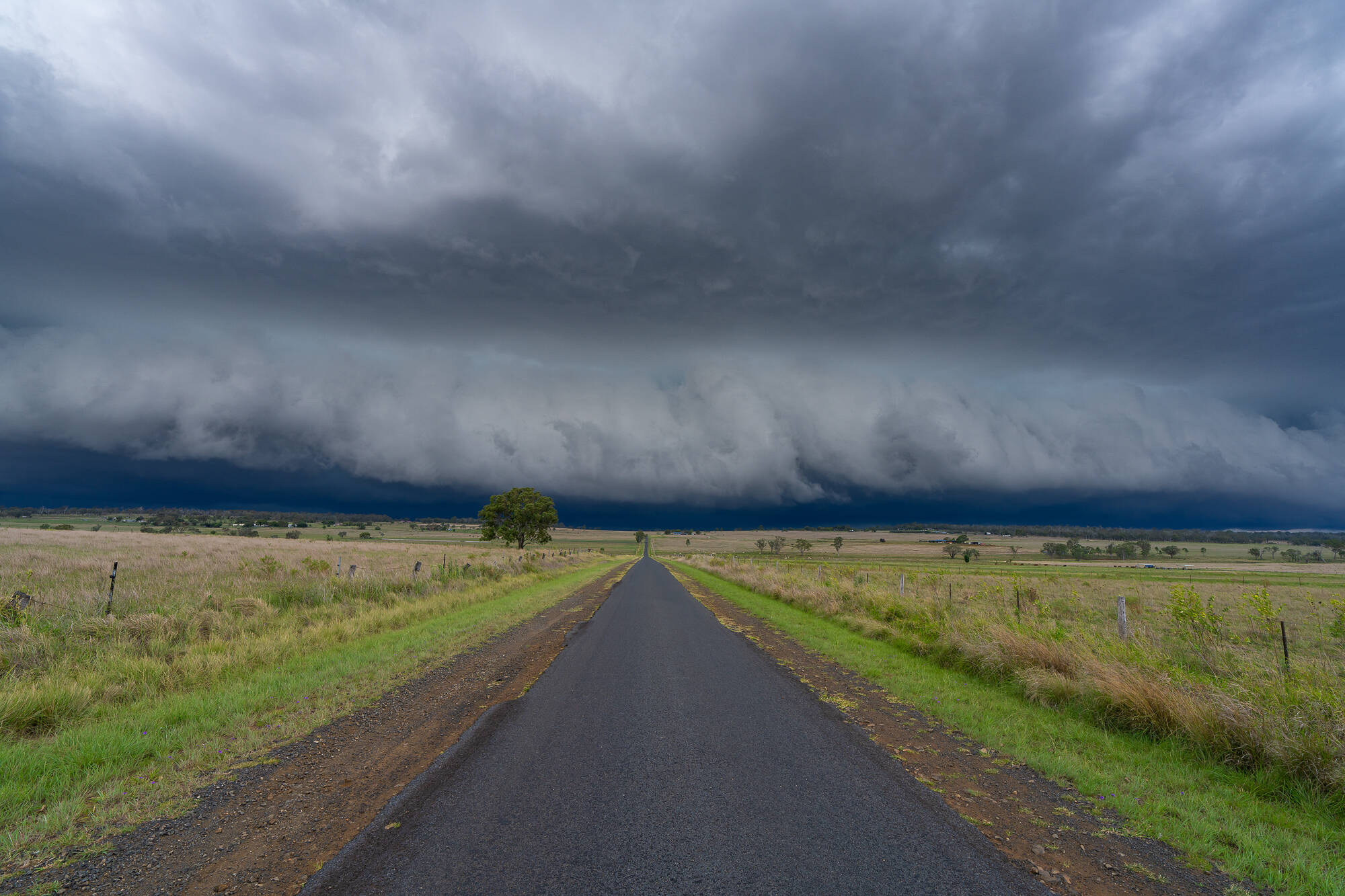
As Brisbane and Southeast Queensland are in the midst of yet another storm clean-up after Monday’s destructive hybrid-supercell complex swept through, one thing is clear to storm-weary locals: this season has been exceptional.
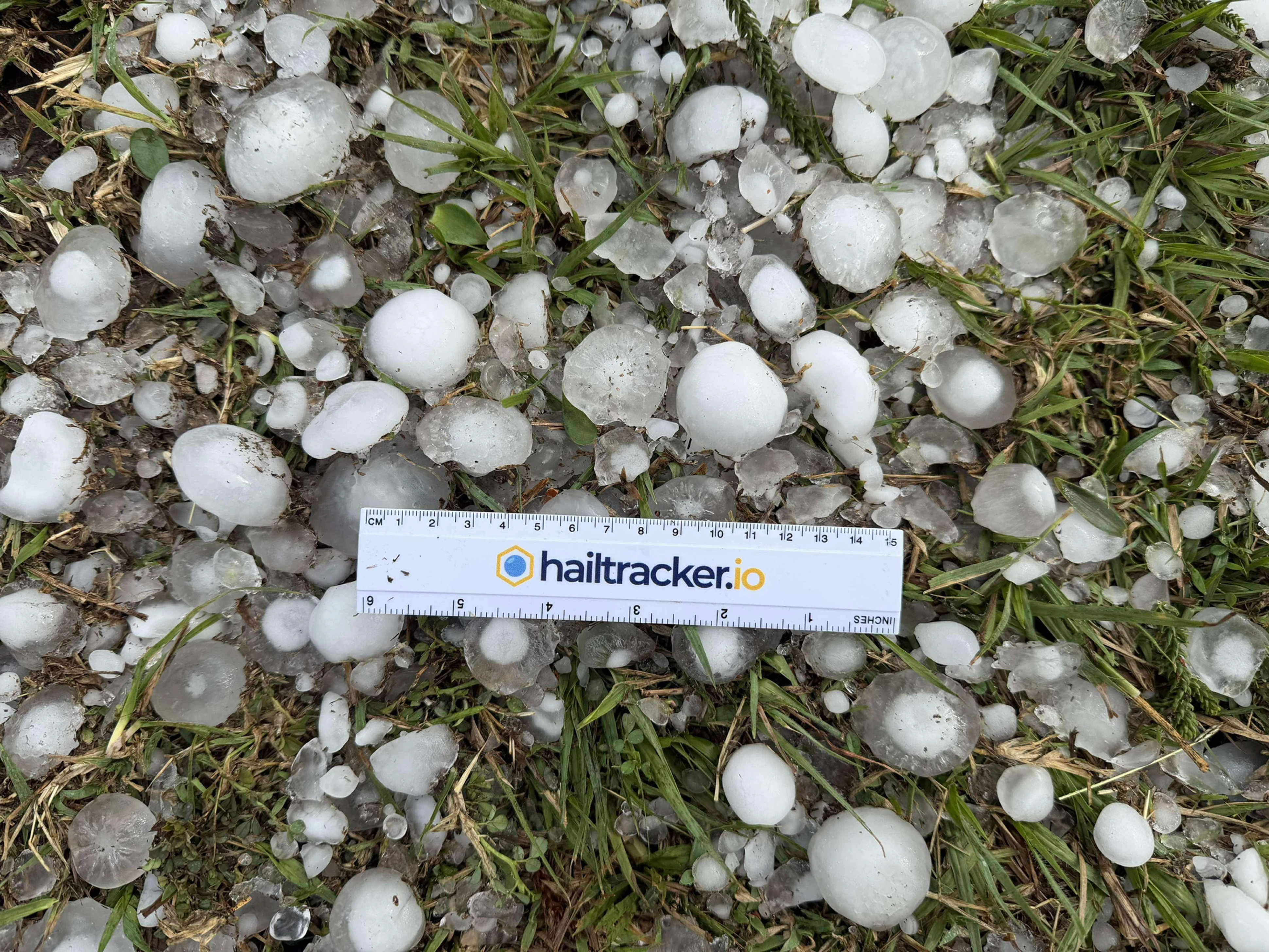
In six weeks, we’ve seen ten days with giant hail across the Southeast Coast — nearly twice per week.
 |
 |
 |
 |
 |
 |
 |
 |
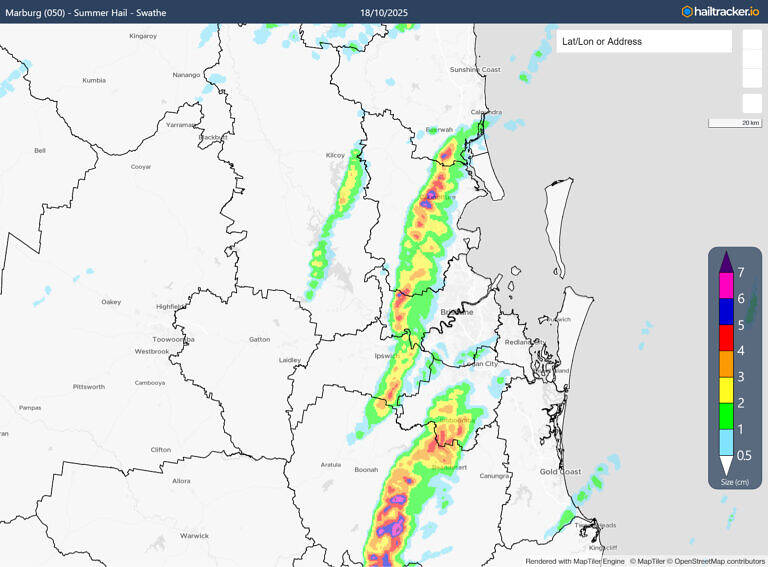 |
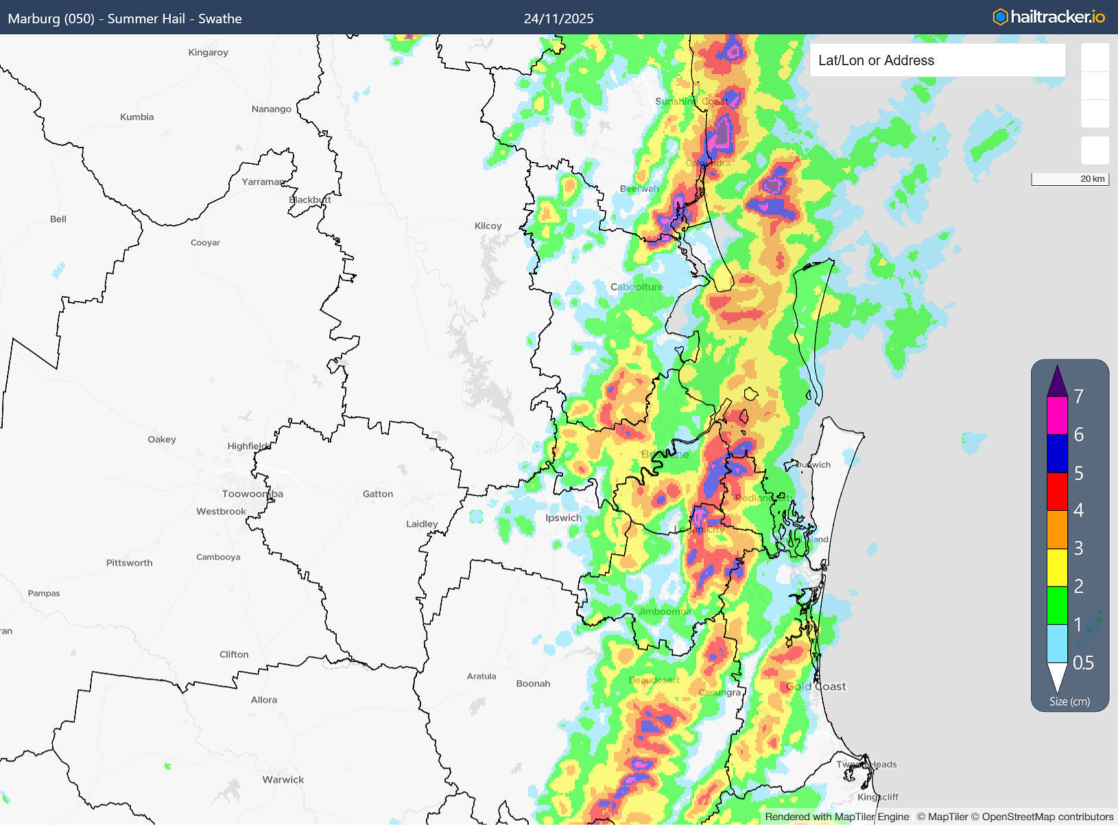
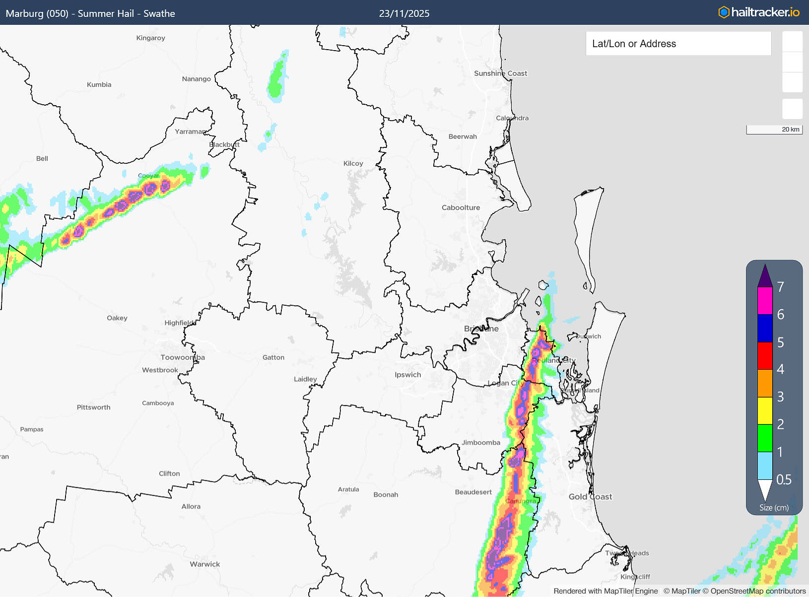
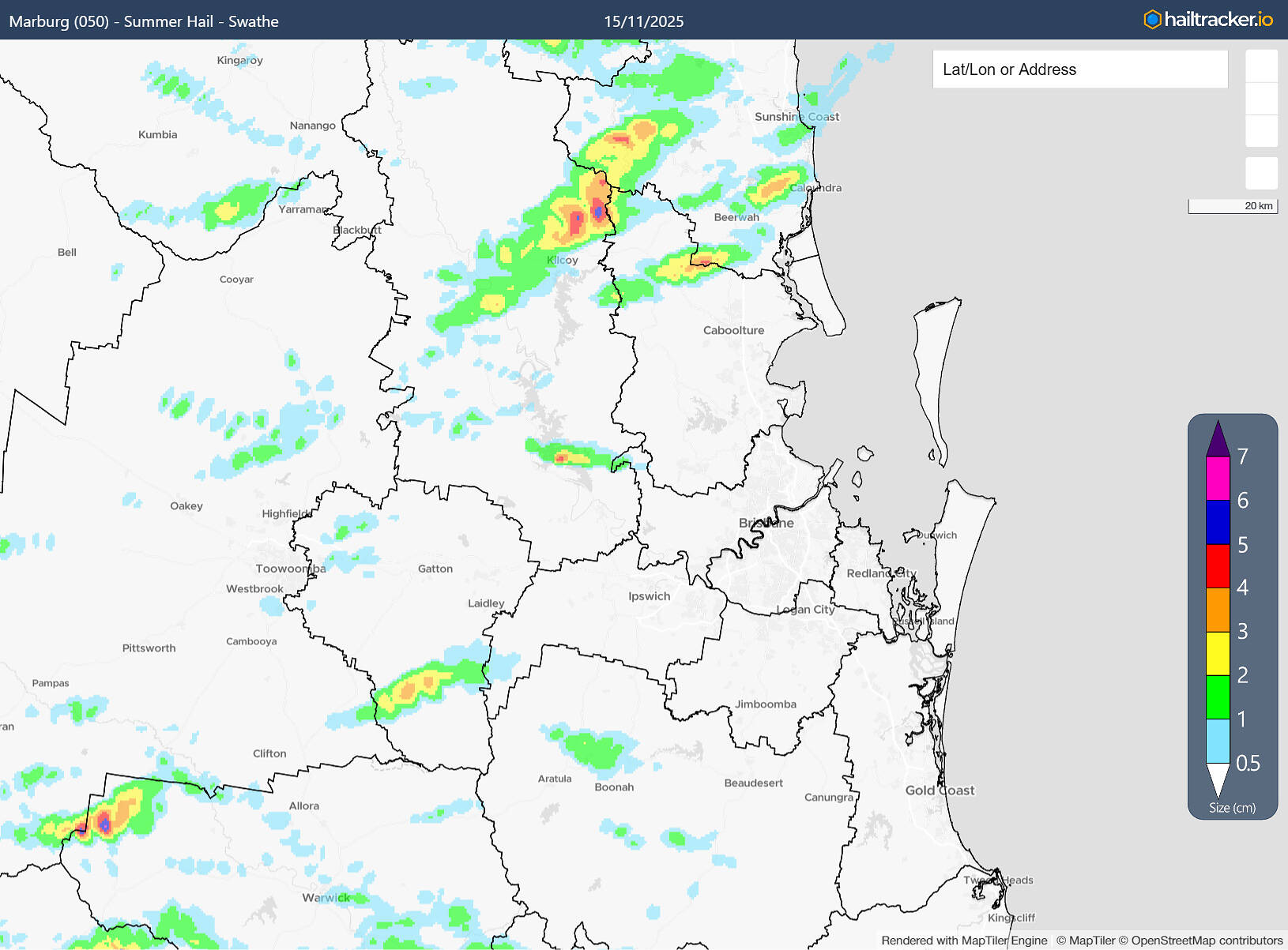
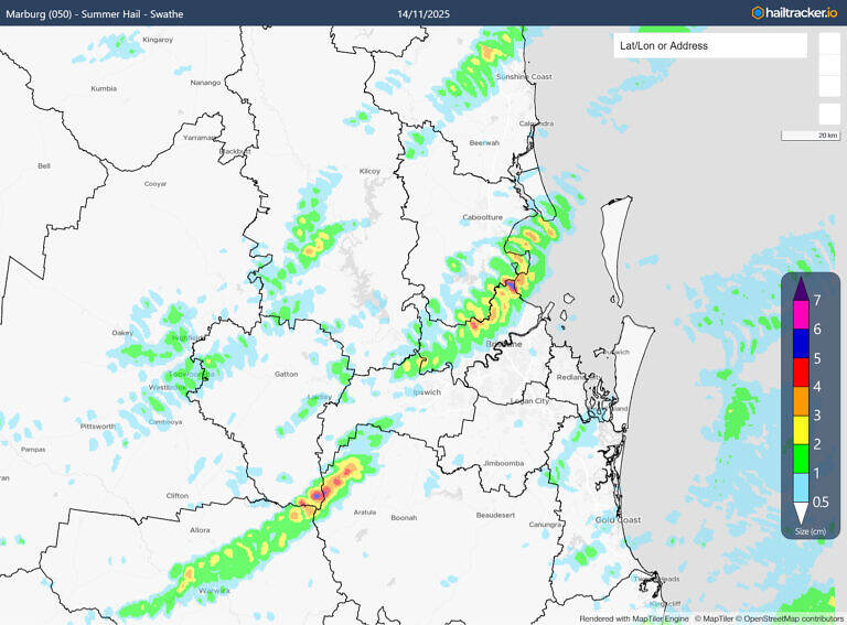
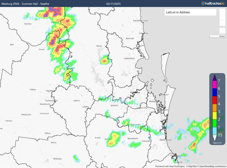
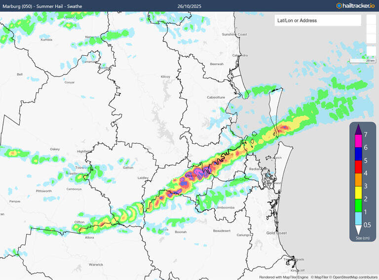
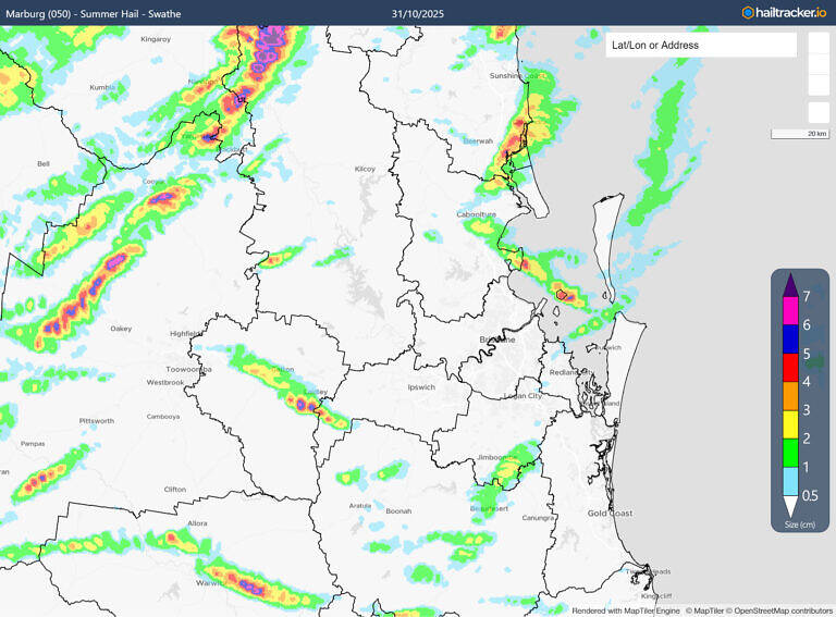
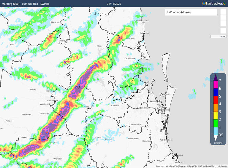
Maps indicating the size of hail for the major hailstorms across Southeast Queensland so far from the 2025 season, with local reports of giant hail occurring in the recent November 27 activity).
Source: Hailtracker.io
So what’s driving the intensity this year?
Brisbane & Southeast Queensland: A Hail and Thunderstorm Hotspot
Before diving into the unusual patterns of 2025, it’s worth remembering that Southeast Queensland has always been a high-risk zone. This region sits in Australia’s “severe thunderstorm alley,” where the key ingredients for dangerous storms regularly line up:
- High instability
- Strong upper-level winds
- A trigger
It’s the perfect storm-making and hail recipe.
Instability: Heat + Humidity + Cold Air Aloft
Warm-season days in Southeast Queensland are famously hot and humid which is a powerhouse combination for building instability. Instability is essentially the ability for air to rise upwards, and the hotter and more humid it is, the more rapidly the air can rise upwards. That’s essential to supporting giant hailstones where updrafts often need to exceed 150km/h to suspend giant hail in the air.
Add bursts of cold air in the upper atmosphere (which periodically arrive thanks to cold fronts and winter systems still traversing through southern Australia) and you get the ideal conditions for not just hail, but severe thunderstorms in general.
Source: WeatherWatch
Upper-Level Winds (and the Seabreeze Advantage)
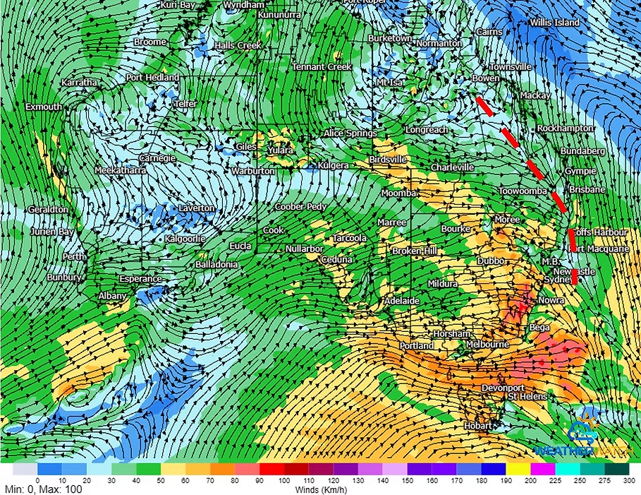
Strong winds high above help thunderstorms organise themselves, keeping their updrafts and downdrafts separated so the storm can sustain itself. Southeast Queensland also has a unique helper: the seabreeze front.
This gusty, humid NE surge often collides with inland storms, injecting extra moisture, while the stronger surface winds help balance out the storm’s gusty, cold outflow that help storms stay balanced and long-lived which is essential for long-lived severe storms.
Source: WeatherWatch
Triggers: Troughs, Fronts, and Mountains
Troughs and cold fronts are classic triggers to help force warm and humid air up into the atmosphere to produce thunderstorms, but in Southeast Queensland, the surrounding mountain ranges do a lot of extra work. They can initiate storms even on marginal days.
The Darling Downs also plays a role as its elevated, hot environment can spark storms that can intensify as they drift into the humid, more capped coastal air.
Source: WeatherWatch
The “Goldilocks Zone”
All of these ingredients can occur anywhere across Australia, but they occur more frequently across broad areas of southeastern Queensland and northeastern NSW. Across tropical Australia there’s plenty of instability but often not much in the way of cold air or strong winds in the upper atmosphere. Across southern Australia there’s plenty of cold air and strong winds in the upper atmosphere, but the heat, humidity and instability is often lacking.
But for Brisbane and the broader areas of southeastern Queensland and northeastern NSW these ingredients occur more often on average than anywhere else.
 |
 |
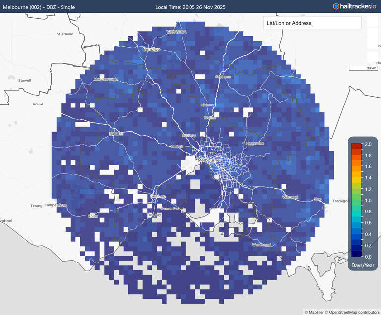 |
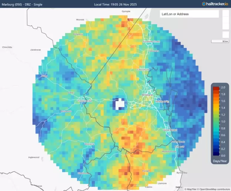
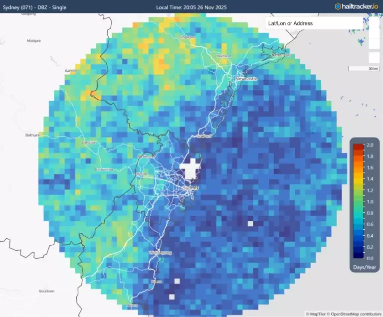
Hail frequency maps for Brisbane, Sydney and Melbourne. Brisbane is the most prone capital city in Australia to large hail.
Source: Hailtracker.io
Why the 2025 Hail Season Is More Intense Than Normal
Despite being a hotspot – there’s no denying that the 2025 season has been unusually active and it’s the result of multiple climate drivers stacking together.
1. A Sudden Stratospheric Warming Event (SSW) – Increasing Westerly Winds
During August and September, a SSW event occurred. These events temporarily disrupt climate patterns and induce a more negative SAM (Southern Annular Mode) phase. Negative SAM phases increase cold front activity across the southern half of Australia – this can increase cold air and winds in the upper atmosphere which are key ingredients for severe thunderstorms.
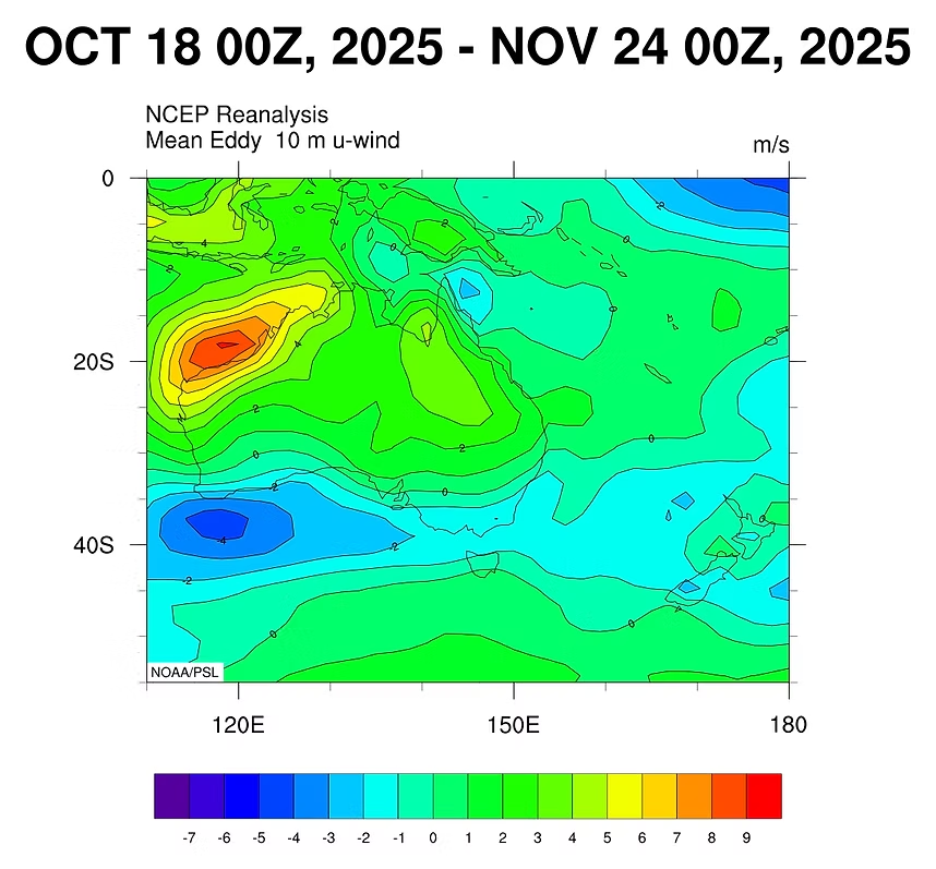
U-Wind Anomaly. Positive values indicate stronger westerly winds than normal and weaker easterly trade winds.
Source: NCEP-NCAR Reanalysis
Trough systems are the bones of the thunderstorm season – these often get pushed around by prevailing broader climate influences, with cold fronts pushing the troughs eastwards while the easterly trade winds across the Pacific Ocean help push these troughs back inland. It’s an inverted tug-of-war, but where this trough lies often determines where the storms will occur.
In this case, the westerly winds from the cold fronts have been strong enough to keep the trough semi-parked across southeast Queensland (but not so strong that it sits offshore and remained too dry). This wasn’t the case during the first half of spring when the westerly winds dominated and kept everything too dry for showers and storms and for many it felt quite similar to the start of 2019, however the climate drivers for 2025 are quite different.
Westerly winds flowing across Australia are colliding with warm and humid N/NE winds helping to generate shower and storm activity over Southeast Queensland with a high frequency.
Source: WeatherWatch
2. A Strongly Negative Indian Ocean Dipole (IOD)
Here’s where 2025 differs from 2019. This year’s negative IOD has been dragging moisture from the Indian Ocean into central and eastern Australia. That’s providing important moisture for thunderstorm initiation.
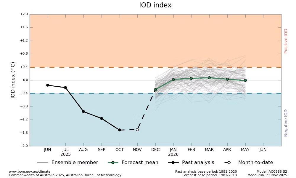
The IOD has been strongly negative this spring helping to bring in moisture from the Indian Ocean.
Source: BoM
3. Weak La Niña / La Niña Modoki & Warm Ocean Temperatures
In order for the trough to lie over the same region, broader climate winds must remain balanced. With a weak La Nina (or possible La Nina modoki) sitting in the Pacific Ocean, this has meant the easterly trade winds haven’t been too strong. But also, aren’t completely absent and has helped to anchor the surface trough over the region during the past 6 weeks.
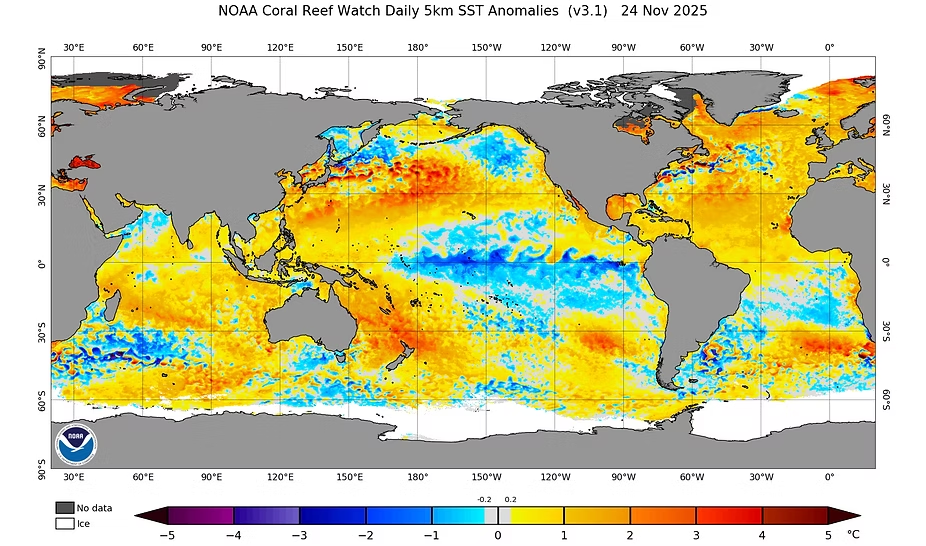
SST anomalies across the globe showing a La Nina-like pattern across the Pacific Ocean, though this is not a classic La Nina.
Source: NOAA
Adding to this – Australia is experiencing a ‘marine heatwave’ with record high ocean temperatures. They’re helping to fuel higher than normal humidity along the east coast which is helping to fuel the strong instability required for severe thunderstorms.
4. Upper Troughs Boosting Wind Shear
Upper troughs (regions of cooler air aloft) have frequently swept across the region thanks to the active period of cold fronts across southeastern Australia. Cooler air upstairs strengthens pressure gradients, increasing wind shear – the final ingredient for well-organised, hail-producing storms.
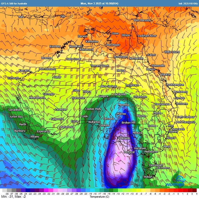
Strong upper troughs often accompany the cold fronts that sweep across the southern areas of Australia.
The Result: Six Extremely Active Weeks
 |
 |
 |
Source: WeatherWatch
With all ingredients lining up consistently, Southeast Queensland has endured one of its busiest hail and thunderstorm periods in years, with frequent giant hail and multiple high-end supercell events.
Interestingly, the past six weeks have closely mirrored patterns identified in our climate driver hail frequency research, which shows that negative SAM phases during the warm season strongly increase hail frequency around Brisbane and Southeast Queensland.
When Will It Settle Down?
Eventually the pattern will break down. Easterly trade winds over the Pacific are likely to re-establish and shift the storm setup back toward something more typical.
But this may not occur fully until mid-December, meaning the next couple of weeks could still deliver more severe storm outbreaks before easing into a more normal late-December pattern.
Are You Storm Season Ready?
This means it’s not too late to prepare for severe weather. At Weatherwatch, our HailTracker platform, real-time hail alerts and weather forecasts have been helping insurers, businesses and solar farms stay ahead of this unusually active season.
We provide immediate visibility of hail size, storm tracks and assets at risk, and we are the only organisation in Australia offering a real-time hail model that updates every 5 minutes with 30-minute hailstorm forecasts.
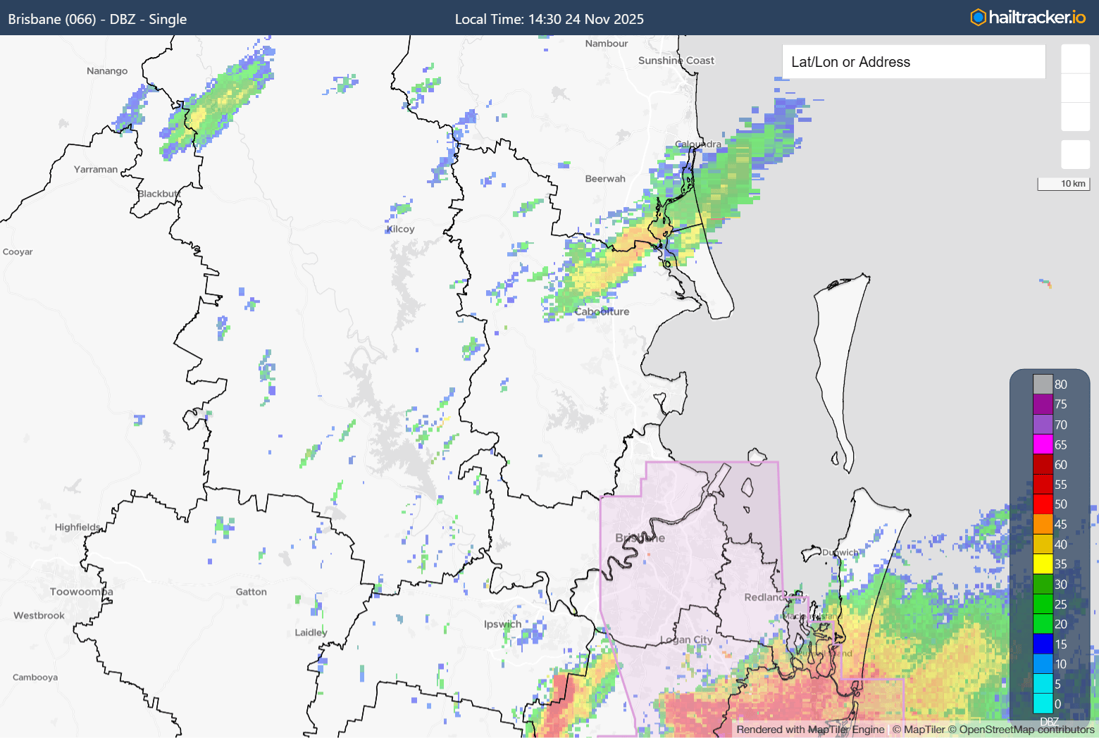
Weatherwatch’s SmartHail system issuing hail alerts ahead of the destructive supercell hailstorm across Brisbane on November 24, 2025.
Source: Hailtracker.io
This article was originally published on WeatherWatch, and has been reposted here with permission.
About our Guest Author
 |
Anthony Cornelius is the Managing Director of WeatherWatch. He has over 20 years of experience in weather forecasting and analysis.
You can find Anthony on LinkedIn here. |
Be the first to comment on "What the hail is happening with Brisbane’s weather?"